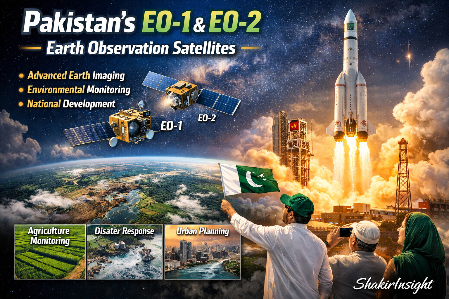
Pakistan’s EO-1 and EO-2 Earth-Observation Satellites
A Scientific but Easy-to-Understand Overview By Dr Shakir Ullah
Pakistan Space agency has been steadily developing its space capability through Earth-observation satellites built under the supervision of Pakistan Space agency named as SUPARCO.
The EO-1 and EO-2 (The complete and easy introduction is below in the article) satellites are designed not for communication or broadcasting, but for scientifically studying the Earth to support agriculture, disaster management, environmental monitoring, and national planning.
These satellites represent an important shift: from relying on foreign data to producing accurate national data independently.
Understanding the Basic Idea: What Is an Earth-Observation Satellite?
An Earth-observation satellite is a spacecraft that circles the planet and measures how sunlight interacts with land, water, vegetation, and atmosphere.

Instead of “taking ordinary pictures,” it performs remote sensing, which means:
Measuring reflected energy from Earth’s surface and converting it into scientific data.
Every surface reflects light differently. By studying these differences, scientists can identify crops, soil condition, water levels, pollution, and land changes.

EO-1: Pakistan’s First Indigenous Electro-Optical Satellite
EO-1 was Pakistan’s first locally developed electro-optical observation satellite. It was launched from Jiuquan Satellite Launch Centre.

Scientific Working Principle
EO-1 observes Earth using multispectral imaging, which means it measures several bands of light:
- Visible light (what human eyes see)
- Near-infrared light (useful for vegetation analysis)
- Reflected radiation from soil and water
Different materials produce different spectral signatures:
| Surface Type | How It Reflects Light | What Scientists Learn |
|---|---|---|
| Healthy vegetation | Strong infrared reflection | Crop health |
| Dry soil | Weak reflection | Drought detection |
| Water bodies | Absorb light | Flood mapping |
| Urban structures | Reflect heat differently | City expansion |
So EO-1 converts light into measurable environmental intelligence.
Key Systems Inside EO-1:
Optical Payload:

A precision lens and filter system that separates light into scientific wavelengths.
Imaging Sensors:

Electronic detectors that convert reflected light into digital signals.
Attitude Control System
Keeps the satellite correctly aligned with Earth so data remains sharp and accurate.
Power Generation System

Solar panels convert sunlight into electricity to run onboard instruments.
Communication Module

Transmits collected information to ground stations for analysis.
EO-2: The Technological Advancement
EO-2, launched from Yangjiang Seashore Launch Centre, was designed to operate alongside EO-1, forming a coordinated observation system.
Rather than duplicating EO-1, EO-2 improves measurement accuracy, speed, and continuity.
Major Scientific Improvements in EO-2
1. Faster Revisit Time:

EO-2 can observe the same location sooner than EO-1 alone.
Benefit:
Near-real-time monitoring of disasters, crop cycles, and environmental change.
2. Improved Imaging Geometry:

EO-2 captures data under different sunlight angles.
Benefit:
Reduces shadow errors and produces more reliable terrain interpretation.
3. Higher Sensor Sensitivity:
More advanced detectors capture weaker signals.
Benefit:
Early detection of drought, land degradation, and subtle climate variations.
4. Better Spatial Resolution

EO-2 can distinguish smaller surface features.
Benefit:
More precise urban planning, irrigation mapping, and infrastructure monitoring.
5. Onboard Data Processing
EO-2 can filter and organize data while still in orbit.
Benefit:
Faster delivery of usable information and reduced transmission load.

Engineering Upgrades in EO-2 Systems
| System | Improvement | Practical Advantage |
|---|---|---|
| Optical System | Higher dynamic range | Clearer environmental contrast |
| Stabilization | More precise orientation control | Sharper imaging |
| Power Units | Efficient solar cells | Longer mission life |
| Onboard Computer | Real-time preprocessing | Faster analysis |
| Thermal Regulation | Better temperature stability | Accurate sensor performance |
Why Launching From Another Country Is a Normal Scientific Practice
Using international launch facilities is common worldwide. Even advanced space nations collaborate for efficiency and cost effectiveness.
For example, American aerospace company SpaceX operates the global Starlink network using shared infrastructure, international tracking stations, and multinational launch coordination.

Advantages of Using Established Launch Centers
- Proven rocket systems reduce mission risk
- Lower cost than building new launch infrastructure
- Access to experienced engineering environments
- Faster deployment timelines
- Allows countries to focus on satellite technology rather than launch vehicle development
In modern space science, collaboration is considered efficient—not dependent.
EO-1 and EO-2 Together: Building a Continuous Observation System
Operating two satellites simultaneously creates what scientists call a satellite constellation.
This enables:
- Continuous monitoring instead of occasional snapshots
- Cross-verification of environmental data
- Long-term climate and land-use tracking
- Reliable datasets for national decision-making
Why These Satellites Matter for Society
Earth-observation satellites directly influence everyday life by supporting:
- Agricultural productivity and food security
- Flood and disaster preparedness
- Climate change analysis
- Water resource planning
- Sustainable urban development
They transform raw environmental signals into actionable scientific knowledge.
Conclusion
EO-1 marked Pakistan’s entry into indigenous Earth observation.
EO-2 strengthened that capability with improved accuracy, faster monitoring, and more advanced onboard technology.
Together, they form the foundation of a national system designed to understand Earth scientifically and support evidence-based development.